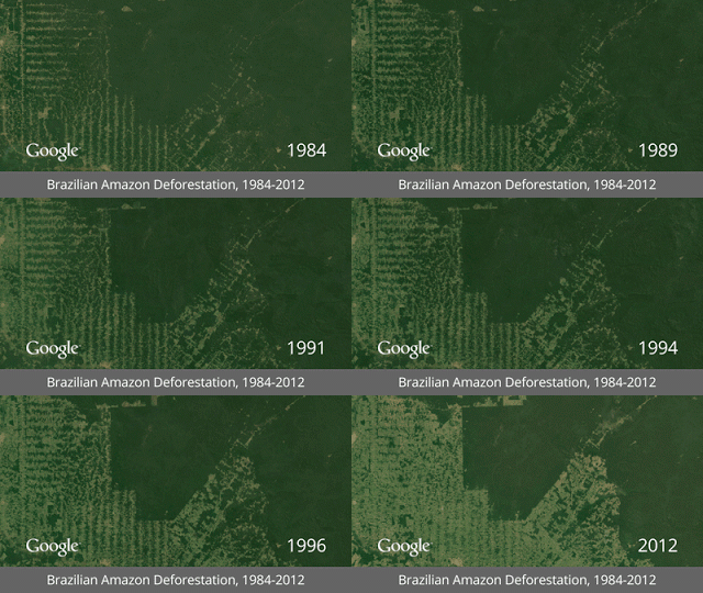
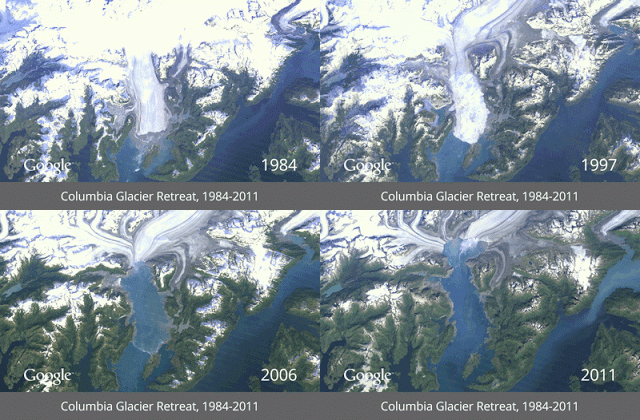
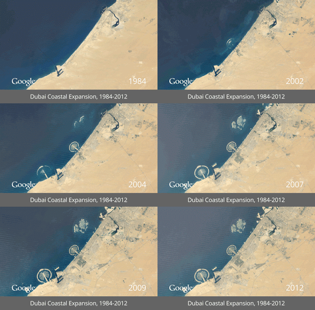
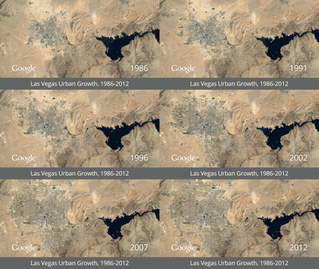
Google and Time magazine have come together to release the animation of Earth timelapse imagery showing the earth’s surface over time, using high resolution satellite images. These GIF images are taken by NASA and U.S Geological Survey in an ongoing joint venture called Landsat. These images show around 28 years (1984- 2012) of Earth’s surface undergoing various changes. 


Earth Timelapse Imagery
Talking about the time-lapse animation released today, engineering manager for Goggle’s Earth Engine & Earth Outreach program, Rebecca Moore wrote in a blog post, “We believe this is the most comprehensive picture of our changing planet ever made available to the public”.
Rebecca further wrote in her blog post, “Much like the iconic image of Earth from the Apollo 17 mission—which had a profound effect on many of us—this time-lapse map is not only fascinating to explore, but we also hope it can inform the global community’s thinking about how we live on our planet and the policies that will guide us in the future.”
The high resolution satellite images of the earth clearly feature the Melting Glaciers in Alaska, Dubai coastal expansion, Urban growth in Las Vegas and deforestation of the Brazilian Amazon.
The satellites of Landsat (joint venture of NASA and U.S Geological Survey) are observing the earth surface since 1970s. These satellites take the images of Earth’s surface and send them back to Earth; these images are then archived on USGS tape drives to make them available online. These Landsat images use 1.8 trillion pixels per frame which is almost the equivalent of 900,000 high-def TVs assembled into a single mosaic.
According to the blog post of Rebecca Moore, Google Earth Engine has been taking the Earth’s imagery for every spot of Earth since 1984. A total of 2,068,467 images (909 terabytes of data) were then compiled into planetary images, which then were converted into this browsable HTML5 animation.
Check out the amazing Earth’s Imagery at Google’s Timelapse website.