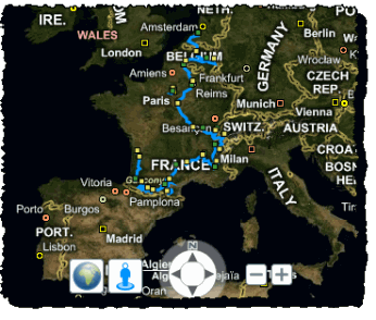
Bing Maps has produced a map application that will bring to you the Tour de France. The new application is designed to help users visualize the overall race, the stages and how variables such as weather and elevation will impact each stage of the Tour de France.

Avid followers can also choose between different views such as road view, aerial view of bird’s eye view. There are several different tab options that provide in depth information, including ‘stages’ and ‘about’.
Bing Maps has also brought in an expert from cycling Web site Podium Café, to explain all the different nuances of the Tour de France course.
The 2010 race kicked off in Rotterdam, the Netherlands on 3 July and ends on 25 July at the Champs Élysées in Paris, France. Competitors will tackle 3,642 kilometres of terrain over 23 different days.
The 97th annual Tour de France began on July 3rd in Rotterdam, Netherlands and will span 23 riding days en route to the finish on July 25th 2010 in Paris, France. Along the 3,642 km of terrain, riders will traverse sunflower filled plains and high-mountain passes as they challenge themselves and each other for the winner’s jersey.
The Bing Maps Tour de France application is designed to help you visualize the overall race, the stages (stages tab + numbers) and how variables such as weather & elevation (elevation profiles) will impact each stage. Results will be updated along the way in the ‘Results’ tab.